Log in
All resources
Create a design
240 Free Artworks of Maps Of Mexico
bibliothèque nationale de france
maps from the earth and its inhabitants, vol. xvi
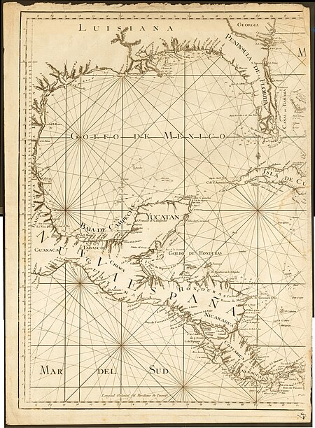
carte du mexique et de la floride by guillaume delisle (1703)
cartography
engraving
chalcography
grabados
fondo antiguo
calcografía
cartografía
1750s maps of central america
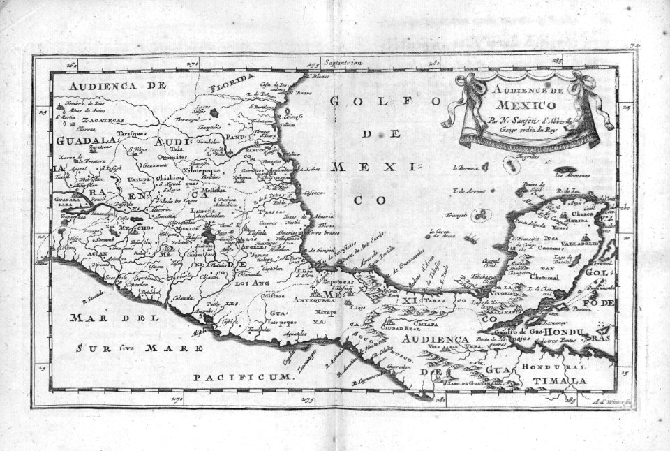
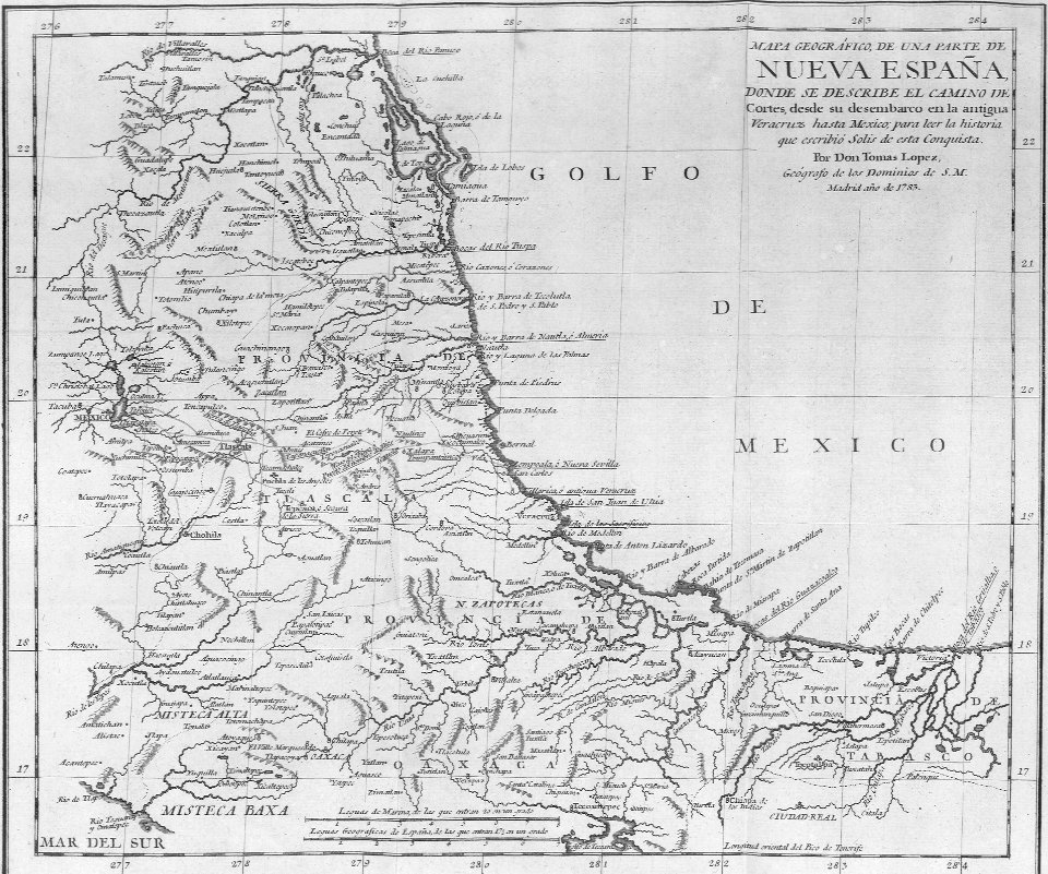
maps by tomas lopez
mexico
maps
1790s maps of central america
1790s maps of cuba
incidents of travel in central america, chiapas, and yucatan (book)
romanticism
cartography
maps
carte du mexique et de la floride by guillaume delisle (1703)
french-language maps of mexico
maps from the earth and its inhabitants, vol. xvi
1870s maps of mexico
backs of postcards in curt teich postcard archives
mexico
maps
chicago and the midwest, newberry library
maps by rand mcnally
maps of mexico by mercator-hondius
history
maps
portrait of george washington by giuseppe perovani
1790s maps of washington, d.c.
album del ferrocarril mexicano
rail transport maps of mexico
maps from the earth and its inhabitants, vol. xvi
19th-century maps of mexico city
1720s maps of the caribbean
maps by pieter mortier
maps in the library of congress
old maps of latin america
juan de la cruz cano y olmedilla
1750s maps of the caribbean
the story of mexico (1889 book)
siege of veracruz
1800s maps of the caribbean
charles picquet
maps from the earth and its inhabitants, vol. xvi
19th-century maps of mexico city
bibliothèque nationale de france
maps by tomas lopez
mexico
maps
admiralty charts region r: usa and mexico west coasts
admiralty charts 401-600
17th-century maps of mexico
maps by gerard valck
maps from the earth and its inhabitants, vol. xvi
surveying in mexico
maps from the earth and its inhabitants, vol. xvi
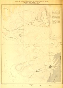
volcanism of mexico
atlas maior, vol 12 (america) - joan blaeu, 1667 - bl 114.h(star).12
1667 maps of north america
maps by daniel lizars
1831 maps of mexico
caribbean maps in leiden university library
files uploaded at wiki techstorm 2019
caribbean maps in leiden university library
files uploaded at wiki techstorm 2019
the story of mexico (1889 book)
battle of molino del rey
everett d. graff collection of western americana
maps of the united states
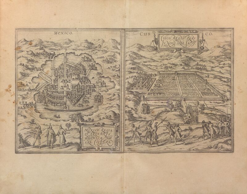
beschreibung der städt der welt - braun & hogenberg - btv1b52512111k
maps of cusco by braun & hogenberg
maps by willem and johannes blaeu
1630s maps of the americas
history
maps
lawrence h. slaughter collection of english maps, charts, globes, books and atlases
nypl lionel pincus and princess firyal map division
maps in the library of congress
1750s maps of the caribbean
bibliothèque nationale de france
maps by tomas lopez
science
maps
atlas minor gerardi mercatoris (1621, maps)
maps of mexico by mercator-hondius
maps of the mexican-american war
maps by joseph warren revere
maps by pieter mortier
maps from gallica
paintings in the musée de la marine de toulon
émile vernet-lecomte
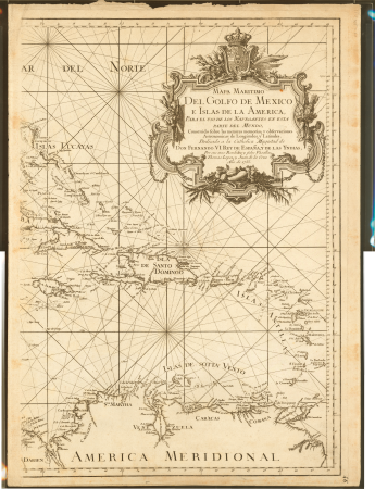
de nieuwe groote lichtende zee-fakkel (rijksmuseum)
maps in the rijksmuseum amsterdam
arnold's geographical handbook (1899)
1890s maps of central america
chicago and the midwest, newberry library
old maps of the mississippi river
nieuwe en beknopte hand-atlas (1754)
backs of postcards in curt teich postcard archives
maps from university of amsterdam special collections
atlas der neederlanden
postcards of motels in gallup, new mexico
curt teich postcard archives
juan de la cruz cano y olmedilla
maps by tomas lopez
juan de la cruz cano y olmedilla
maps by tomas lopez
picturesque journey to the two americas, asia and africa
puebla in art
maps from the earth and its inhabitants, vol. xvi
maps of the history of mexico
maps from the earth and its inhabitants, vol. xvii
maps of native american tribal territories
maps from the earth and its inhabitants, vol. xvi
1870s maps of mexico
description de l'universe
alain manesson mallet
maps from the earth and its inhabitants, vol. xvi
maps of the mexican war of independence
carte du mexique et de la floride by guillaume delisle (1703)
bibliothèque nationale de france
bibliothèque nationale de france
cartouches by tomas lópez
maps by gouverneur k. warren
maps by edwin freyhold
lawrence h. slaughter collection of english maps, charts, globes, books and atlases
covens en mortier
carte du mexique et de la floride by guillaume delisle (1703)
maps in the library of congress
old maps of the london underground
maps by macdonald gill
1750s maps of california
philippe buache
beschreibung und contrafactur der vornembster stät der welt, liber primus civitates orbis terrarum
maps of mexico city by braun & hogenberg
atlas sive cosmographicae (gerardus mercator, 1607)
maps of mexico by mercator-hondius
maps from the earth and its inhabitants, vol. xvi
ethnographic maps of north america
atlas minor gerardi mercatoris (1614, maps)
maps of mexico by mercator-hondius
1696 maps of the caribbean
1690s maps of mexico
maps of mexico by mercator-hondius
bibliothèque nationale de france
maps from the earth and its inhabitants, vol. xvi
maps of mexico
atlas sive cosmographicae (gerardus mercator, 1623)
maps of mexico by mercator-hondius
media contributed by university of illinois urbana-champaign university library
carte du mexique et de la floride by guillaume delisle (1703)
a map of the british empire in america with the french and spanish settlements adjacent thereto
bibliothèque nationale de france
a map of the british empire in america with the french and spanish settlements adjacent thereto
bibliothèque nationale de france
maps from the earth and its inhabitants, vol. xvi
topographic maps of mexico
maps from the earth and its inhabitants, vol. xvi
19th-century maps of mexico city
maps from the earth and its inhabitants, vol. xvi
maps of weather and climate of mexico
maps from the earth and its inhabitants, vol. xvi
archaeological maps of mexico
a map of the british empire in america with the french and spanish settlements adjacent thereto
bibliothèque nationale de france
a map of the british empire in america with the french and spanish settlements adjacent thereto
bibliothèque nationale de france
a map of the british empire in america with the french and spanish settlements adjacent thereto
bibliothèque nationale de france
maps from the earth and its inhabitants, vol. xvi
maps of the history of mexico
maps from the earth and its inhabitants, vol. xvi
maps of agriculture in mexico
maps from the earth and its inhabitants, vol. xvi
population density maps of mexico
history of puebla, puebla
biblioteca palafoxiana
incidents of travel in central america, chiapas, and yucatan (1858)
romanticism
portrait of george washington by giuseppe perovani
giuseppe perovani
nouvelle géographie universelle, vol. xvii
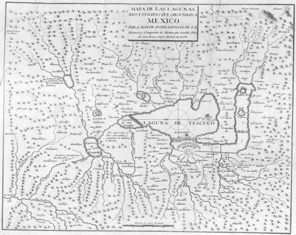
maps of texcoco lake, mexico
carte du mexique et de la floride by guillaume delisle (1703)
bibliothèque nationale de france
maps from the earth and its inhabitants, vol. xvi
volcanism of mexico
maps from the earth and its inhabitants, vol. xvi
mountains of mexico
maps
city
cartography
maps
old geological maps by jean-etienne guettard
jean étienne guettard
admiralty charts region r: usa and mexico west coasts
admiralty charts 1801-2000
old geological maps by jean-etienne guettard
jean étienne guettard
atlas sive cosmographicae (gerardus mercator, 1630)
maps of mexico by mercator-hondius
101 - 200 of 240
Next page
/ 3


![Gulf of Mexico Map - *J. v. Schley & Bellin Marine Engraving*, Jakob van der Schley, [1773]](https://cdn.creazilla.com/illustrations/10000578116/gulf-of-mexico-map-j-v-schley-bellin-marine-engraving-jakob-van-der-schley-1773-md.jpg)


![Beschreibung und Contrafactur der Vornembster stät der Welt, liber primus [Civities of the World], 1574](https://cdn.creazilla.com/illustrations/10000603316/beschreibung-und-contrafactur-der-vornembster-st-t-der-welt-liber-primus-civities-of-the-world-1574-sm.jpg)